Mt. Kilimanjaro Trekking 7 Days Machame Route

Duration
7 Days
Destination
Mt Kilimanjaro
Travellers
50+
  • Tour Overview
  • Tour Plan
  • Tanzania Destinations
  • Similar Tours

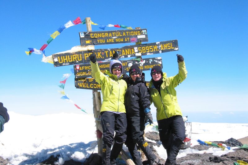
Kilimanjaro Climb 7 Days Machame Route


The Machame is a wilderness route which combines spectacular views and scenery, good acclimatization and which is quieter than the Marangu (tourist) route. For all these reasons it is perhaps the best of the standard routes on the mountain, and the one recommended for those wanting an uncomplicated but rewarding trek on Kili.

Book early to secure your place on the most popular route on Kilimanjaro! Our Machame Route 7 Days package is perfect for both seasoned adventurers and first-time high altitude climbers. It offers excellent acclimatisation, making for a high success rate.

What's included

Destination
Mt Kilimanjaro Discover Mt Kilimanjaro
Additional Information
Visas: Visas are required for all visitors
Price includes
  • A guided tour of important places
  • All meals while on the mountain
  • All transfers to the mountain and back to your Moshi hotel
  • Beautifully illustrated souvenir map
  • Community Development Fund
  • Fair Wages
  • Guides, Porters, cook salaries and park fees
  • Increases in airfares or Government imposed taxes
  • Kilimanjaro Certificates after Trek
  • Kilimanjaro National Park Entrance fees
  • Medical insurance and emergency insurance
  • Other International flights
  • Professionally guided tour
  • Quality mess tents with table and chairs
  • Quality, waterproof, four seasons private mountain sleeping tents
Price does not include
  • Laundry Services
  • Other International flights
  • Personal expenses
  • Tips to Mountain Crew
  • Visa arrangements
  • Day 1
  • Day 2
  • Day 3
  • Day 4
  • Day 5
  • Day 6
  • Day 7
Day 1

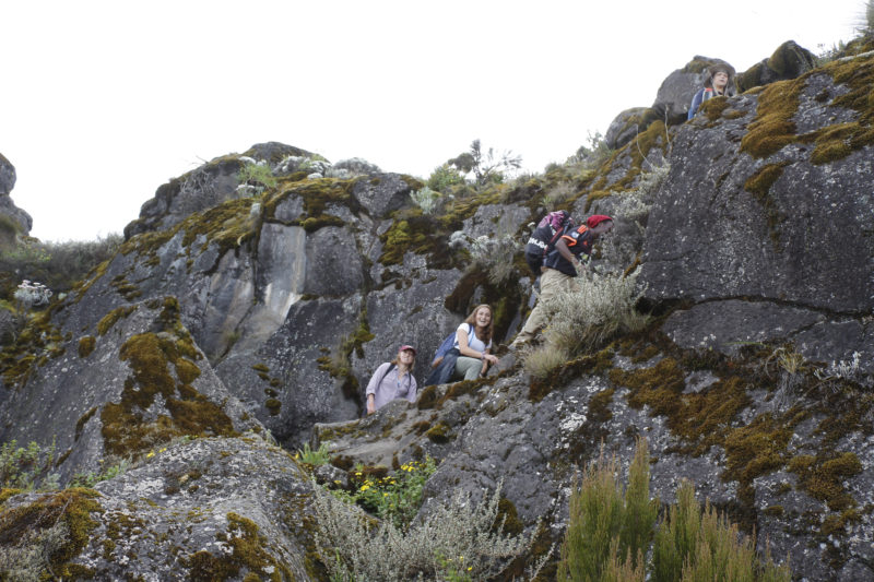
Machame Gate (1490m) – Machame Camp (2980m) Hiking time: 7 hours Distance: Approximately 18 kilometers Habitat: Montane forest

After an early breakfast at your hotel, you will be picked up from Arusha (1400m) and driven to the Machame Village. In the village, you can buy mineral water and will receive a packed lunch. From the village, depending on the road conditions, you will either continue driving 3 kilometers or walk to the Machame Gate (1490m).

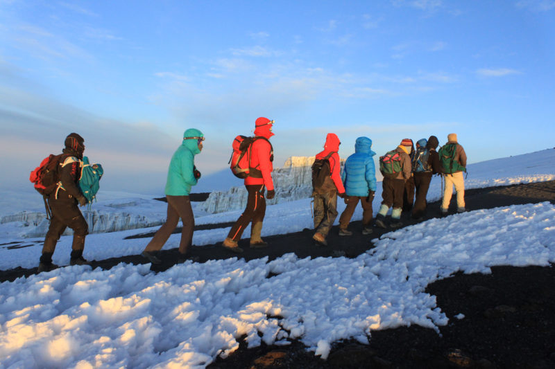
At the gate, the porters will organize and pack the belongings for the hike while you and your guide register with the Tanzania National Park (TANAPA). You will then begin your ascent into the rainforest. During this section of the hike, you should expect rain, mud, and fog. Also, be on the look out for wildlife, including Colobus monkeys! About halfway up the trail you will have a lunch break and you will reach the Machame Camp (2980) in the late afternoon or early evening.

The porters and chef, who move very fast up the mountain, will reach camp before you and set up your tents, boil drinking water, and prepare snacks for your arrival. After washing up, a hot dinner will be served. For overnight, mountain temperatures may drop to freezing so be prepared!

Day 2

Machame Camp (2980m) – Shira Camp (3840m) Hiking time: 6 hours Distance: Approximately 9 kilometers Habitat: Moorland

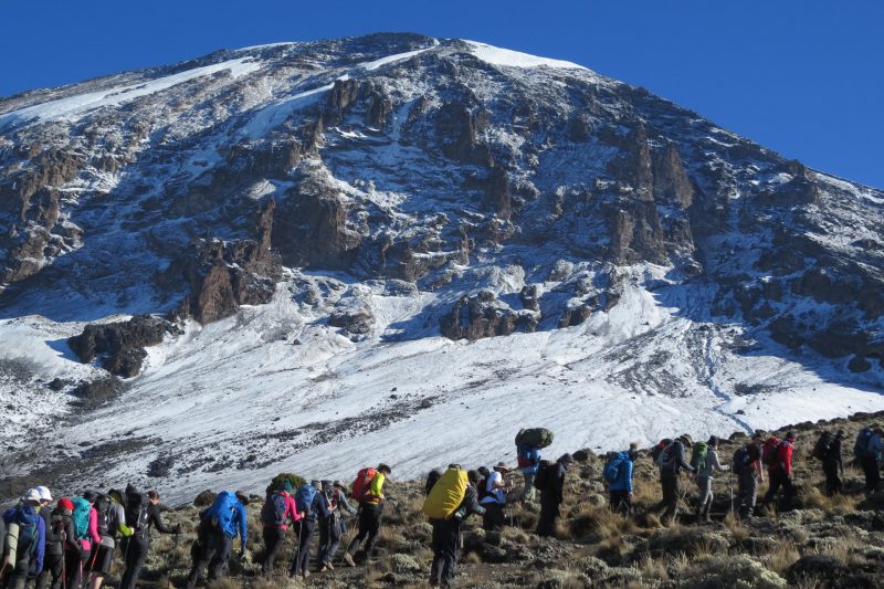
After an early morning breakfast, you will start you ascent leaving the rain forest and entering the heathland moorland vegetation. You will cross many streams and walk over a rocky ridge onto the Shira plateau that leads to Shira Camp (3840m). At this campsite, you will be next to a stream and have a spectacular view of the Western Breach and its glaciers in the East. Similar to the first night, your tents will be set up prior to arriving at camp and the porters will prepare drinking and washing water for you. You will enjoy evening snacks then dinner prepared by our chef. Be prepared for a cold night as temperatures drop below freezing at this exposed camp.

Day 3

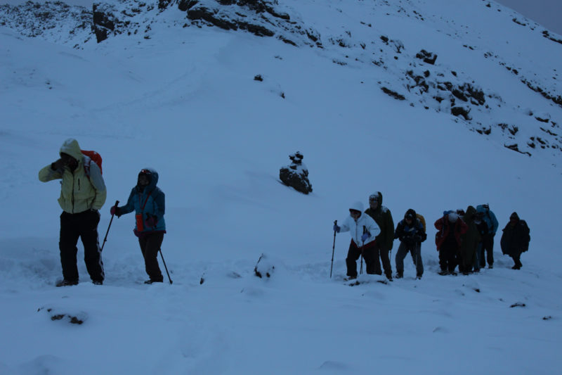
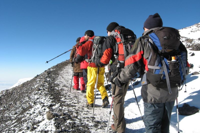
Shira (at 3840m) – Lava Tower (at 4630m) – Barranco camp (at 3950m) Hiking time: 7 hours Distance: Approximately 15 kilometers Habitat: Semi-desert

Following an early morning breakfast, you will leave the moorland environment and enter the semi desert and rocky landscape. After 5 hours of walking east, you will be come face to face with the Lava Tower (4630m).
 
Packed lunches are served at the Tower and hikers have the option of climbing the massive Lava Tower weather permitting. At this point of the hike, it is normal for hikers to start feeling the effects from the altitude including headaches and shortness of breath.
 
After lunch, you will descend from Lava Tower (4630m) to the Barranco Campsite (3950m). The 6800m descent gives hikers a huge advantage to allow their bodies to adjust to the conditions of high altitude. The descent to camp takes around 2 hours to reach. It is located in a valley below the Breach and Great Barranco Wall (“Breakfast Wall”). Drinking and washing water and dinner will be served as hikers view the sun setting.
Day 4

Barranco Camp (3950m) – Karanga Camp (3950m) Hiking time: 4-5 hours Distance: Approximately 5 kilometers Habitat: Alpine desert

After an early morning breakfast, it is now time to conquer the Great Barranco Wall! Although it may look intimating at first glance, hikers state that this Class 2 hike is usually much easier than they anticipated. At the top of the Wall, you will have a view of Heim Glacier and will be above the clouds. The trail then winds up and down in the Karanga Valley. This is an ideal hiking day for acclimati

Day 5

Karanga Camp (3959m) – Barafu Hut (4600m) Hiking time: 2-3 hours Distance: Approximately 4 kilometers Habitat: Alpine desert

Following breakfast, you will leave Karanga Camp (3959m). The trail intersects with the Mweka Route, which is the trail used to descend on the final two days. As you continue hiking for an hour, you will reach Barafu Hut. This is the last water stop for the porters because there is no accessible water at Barafu Camp (4550m).
 
The word “barafu” in Swahili means “ice” and this camp is located on a rocky, exposed ridge. Tents will be exposed to wind and rocks so it is important for hikers to familiarize themselves with the campsite before dark. An early dinner will be served so hikers can rest before attempting the summit the same night.
Your guide will brief you in detail on how to prepare for summit night. Get to sleep by 19:00!
Day 6

Summit Attempt Barafu camp (4600m) – Uhuru Peak (5895m) – Mweka (3100m) Hiking time: 8 hours to reach Uhuru Peak, 7-8 hours to descend to Mweka Distance: Approximately 7 kilometer ascent and 23 kilometer descent Habitat: Stone scree and ice-capped summit

Your guide will wake you around 23:30 for tea and biscuits. You will then begin your summit attempt. The route heads northwest and you will ascend over stone scree. During the ascent, many hikers feel that this is the most mentally and physically challenging part of the climb.
 
In about 6 hours, you will reach Stella Point (5685m), located on the crater rim. After enjoying the magnificent sunrise, you will continue ascending for about 2 hours on a snow-covered trail to Uhuru Peak (5895m). Reaching the summit of Mt. Kilimanjaro is a lifetime accomplishment! You will be able to spend a short time on the summit taking photographs and drinking tea before the descent to Barafu begins.
 
The hike down to Barafu Camp takes about 3 hours. At camp, you will rest and enjoy a hot lunch in the sun. After eating, you will continue descending down to Mweka Hut (3100m). The Mweka Trail will lead you through the scree and rocks to the moorland and eventually into the rain forest. Mweka Camp (3100m) is located in the upper rain forest, so fog and rain should be expected. You will have a dinner, wash, and rest soundly at camp.
Day 7

Mweka camp (3100m) – Mweka Gate (1980m) Hiking time: 3 hours Distance: Approximately 15 kilometers Habitat: Forest

Following a well-deserved breakfast, your staff will have a big celebration full of dancing and singing. It is here on the mountain that you will present your tips to the guide, assistant guides, chef(s), and porters.
 
After celebrating, you will descend for three hours back to Mweka Gate. The National Park requires all hikers to sign their names to receive certificates of completion. Hikers who reached Stella Point (5685m) receive green certificates and hikers who reached Uhuru Peak (5895m) receive gold certificates.
 
After receiving certificates, hikers will descend into the Mweka village for 1 hour (3 kilometers). You will be served a hot lunch then you will drive back to Arusha/Moshi for long overdue showers and more celebrations.

More about Mt Kilimanjaro

MT KILIMANJARO

Kilimanjaro. The name itself is a mystery wreathed in clouds. It might mean Mountain of Light, Mountain of Greatness or Mountain of Caravans. Or it might not. The local people, the Wachagga, don’t even have a name for the whole massif, only Kipoo (now known as Kibo) for the familiar snowy peak that stands imperious, overseer of the continent, and the summit of Africa.   Kilimanjaro, by any name, is a metaphor for the compelling beauty of East Africa. When you see it, you understand why. Not only is this the highest peak on the African continent; it is also the tallest free-standing mountain in the world, rising in breathtaking isolation from the surrounding coastal scrubland – elevation around 900 metres – to an imperious 5,895 metres (19,336 feet).   Kilimanjaro is one of the world’s most accessible high summits, a beacon for visitors from around the world. Most climbers reach the crater rim with little more than a walking stick, proper clothing and determination. And those who reach Uhuru Point, the actual summit, or Gillman’s Point on the lip of the crater, will have earned their climbing certificates. And their memories.   But there is so much more to Kili than her summit. The ascent of the slopes is a virtual climatic world tour, from the tropics to the Arctic. Even before you cross the national park boundary (at the 2,700m contour), the cultivated foot slopes give way to lush montane forest, inhabited by elusive elephant, leopard, buffalo, the endangered Abbot’s duiker, and other small antelope and primates. Higher still lies the moorland zone, where a cover of giant heather is studded with otherworldly giant lobelias.   Above 4,000m, a surreal alpine desert supports little life other than a few hardy mosses and lichen. Then, finally, the last vestigial vegetation gives way to a winter wonderland of ice and snow – and the magnificent beauty of the roof of the continent.

About Us


Karibu, Welcome to Tanganyika Travel the official site for Tanzania Tourism Explorer Tanzania holidays and discover the best time and place to visit.

  • Rindi Road Rengua Street Moshi TZ
  • info@tanganyikatravels.com
  • +255 715 561 781

Our Location

Facebook Page

Copyright © 1999 - 2024 Tanganyika Travels. All Rights Reserved. - Designed By Technoclick Tanzania

Close

7 Days Machame Route

Duration
7 Days
Destination
Mt Kilimanjaro
Travellers
50+

    Fill out the form to book the Tour. Required fields are marked *

    [tour_date]


      Enquiry about the Tour availability or anything you’d like to know. Required fields are marked *


      Notice: ob_end_flush(): Failed to send buffer of zlib output compression (1) in /home/tanganyikatravel/public_html/wp-includes/functions.php on line 5420

      Notice: ob_end_flush(): Failed to send buffer of zlib output compression (1) in /home/tanganyikatravel/public_html/wp-includes/functions.php on line 5420